May 2023.
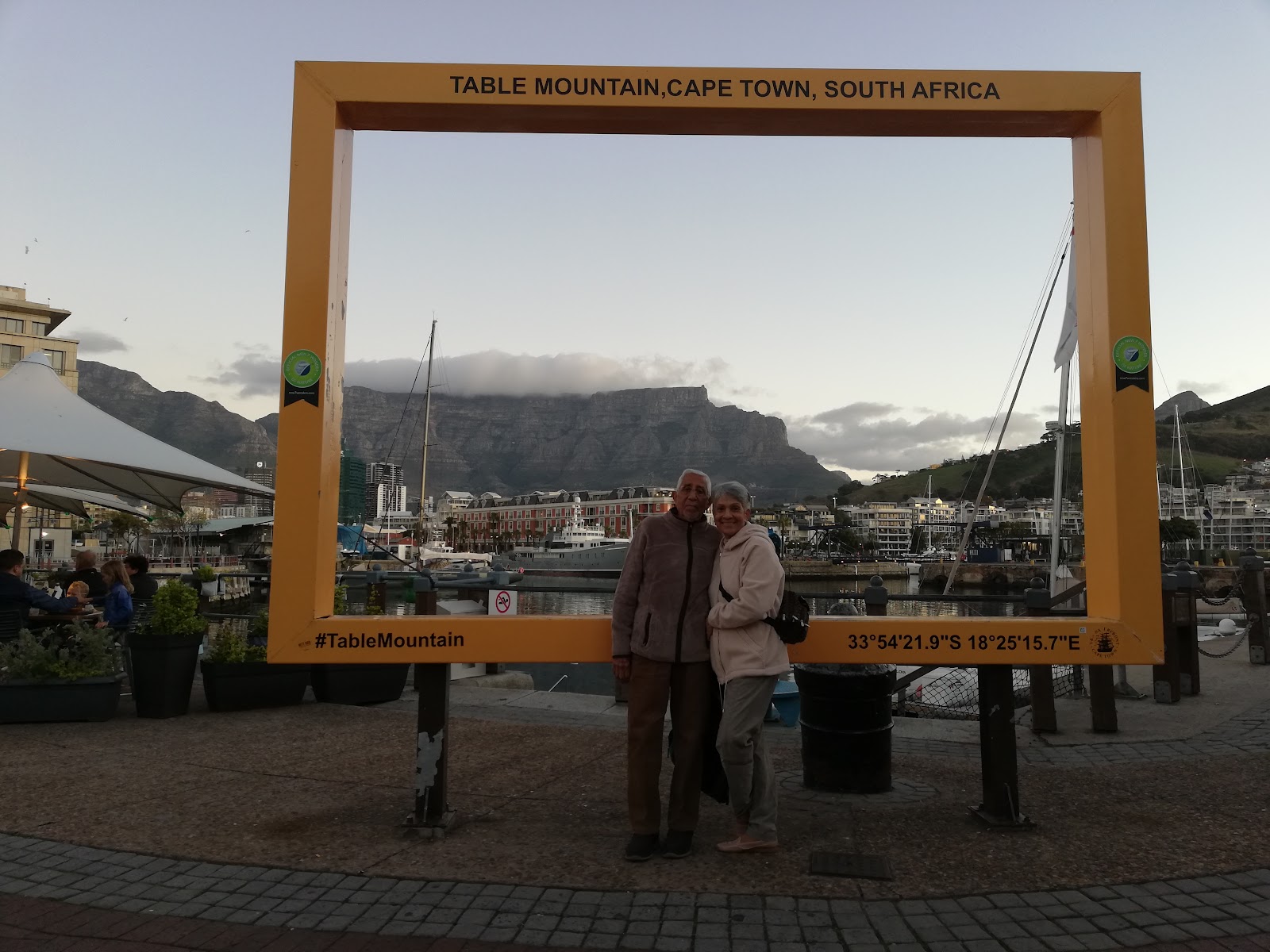
Capetown, South Africa's oldest city, and capital, was recently hailed as one of the most beautiful cities in the world.
From flat-topped Table Mountain, down to the blue waters of the Atlantic Ocean, Cape Town is simply stunning. But beneath this visual spectacle, there is much to be discovered in its rich cultural diversity and historical tapestry. Centuries of history as a trading port have given Cape Town a cosmopolitan multiculturalism that fuses warm African hospitality with Mediterranean charm.
Its flourishing arts scene, dining, and nightlife, are proof of this modern metropolis' creativity and innovative spirit, resulting in a kaleidoscope of vibrancy and colour.
The Zeitz Museum is a reinvention of a historic seafront grain silo, housing an ever changing roster of exhibits celebrating African art...it was just mind boggling how they transformed a grain silo into an architectural wonder.
It’s a city where you’ll spend your days outdoors and your nights enjoying the city’s legendary culinary scene. One can never have enough of the "Victoria and Alfred Waterfront", for food, music, yachts in the harbour, and local shops and craft galore.
For me, it was love at first sight...that first glimpse from the top of Table Mountain, presiding over a spectacular coastline, lapped by brilliant blue waters, is an image that leaves you instantly hooked. People were paragliding and abseiling from the top, or trekking up and down neighbouring Lions Head mountain where hiking trails are absolutely spectacular.

The city’s Cape Malay Quarter, Bo-Kaap, is rich with history, and as famous for its spice shops and cobbled streets as its brightly painted houses. A guided walking tour is ideal, unpacking the history of the suburb and its links to slavery, and stopping for a taste of traditional Cape Malay cooking in local kitchens.
Besides all of the the above, Capetown is also the gateway to animal safaris in south Africa, Ostrich farms where you can ride them and take home a carved egg , home to the legendary Nelson Mandela, where the Cape of Good Hope guided seafarers , where the Indian and Atlantic Oceans meet, where one can go shark cage diving from the safety of a cage, whale watching, and so much more.
Capetown is also where we began our journey into the crossroads of history. It is where we boarded our cruise ship the SS Mariner of the Regent of the Seven Seas, on the 6th of May 2023, to explore the western coast of Africa.
8th May - Namibia
After 2 days at sea to rest from our jetlag, getting to know fellow travelers, and explore the ship, our first port of call was Walvis Bay in Namibia, in southwest Africa.
After 106 years of German and South African rule, Namibia became independent on March 21, 1990, under a democratic multiparty constitution. The capital of the country is Windhoek.
The Namib is one of the most ancient deserts in the world. Although there is some debate about exactly how old it is, it’s generally accepted that this narrow coastal tract has been at least semi-arid, and in places totally arid, for around 50 to 80 million years. The great sea of sprawling sand dunes, some vividly coloured, that cascade down to the very edge of the Atlantic, however, only date back some five million years. It is no wonder that it is the least densely populated country in the world with a population of only 2 and a half million!
Spanning over 2 000 kilometers (1 200 miles) the Desert only receives between 2 millimeters to 200 millimeters of rain per year making it the only true desert in the whole of southern Africa.
Despite this, the desert is also home to a variety of unique plant and animal species, in this seemingly barren and desolate landscape. When one looks closely, one will notice small but very significant signs of life, life that is sustained by the life giving fog that regularly occurs here. This fog is formed when the cold Atlantic current sweeps northwards up and along the south-western coast of Africa and meets with the warmer currents. The water from this current then evaporates and forms a life giving fog along the coast. A light sea breeze blows the fog down onto the Desert .The fog settles on surface of the desert during the day and then the cooler temperatures at night cause it to condense providing all the nutrients and water the desert plants need to survive.
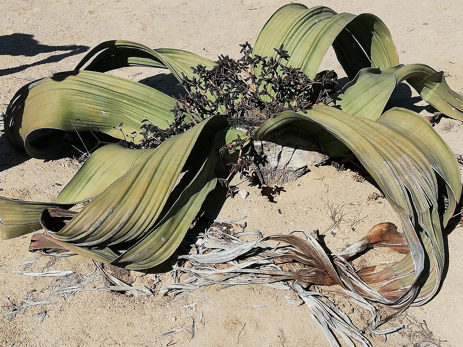
One of the most remarkable plants found in Namibia is the bizarre looking Welwitschia, which biologists claim existed in the dinosaur age! It resembles a wilted lettuce, almost 2 meters in diameter! The plant is endemic to the Namib Desert and can survive upto 500 years.
This and many other plants that survive in the desert have developed the ability to absorb the water straight through their leaves and parts that are above the soil rather than through their roots that are buried below the surface.
Like the Welwitschia, these plants generally have large expansive leaf systems that capture as much moisture as possible, from the fog. Wonders of nature !
There is also a profusion of bird species, and fur seals and dolphins along the coast.
Thus bird watching is a popular sport with visitors, together with sand boarding, sand skiing, and sand duning in 4 wheel drive vehicles. It was good to know that tourism earns much revenue, giving much needed jobs to the locals. We discovered that cruise ships like ours often dock here and along the west coast of Africa.
During German colonization, while digging to build a railway, diamonds were discovered in Namibia. Until today, it remains the basis of their economy, together with a variety of metals like uranium, gold and silver, salt and offshore oil.
Our next port of call was the farthest away in the duration of our cruise.
We had 3 sea days ahead of us sailing towards the Gulf of Guinea, notorious for piracy. From the moment we boarded the ship in Capetown, we were given this notice. 👇👇👇
Although we practiced keeping curtains drawn after dark, the activities on board were ongoing till late every night.
A cruise ship like ours is no attraction to the pirates. They take hostage mostly oil tankers, syphon off the oil, and get good money for it. But it was the duty of the captain to warn us and take precautions, until we cleared the region.
Sea days also gave us time to get to know our fellow passengers and the friendly crew and officers. Captain Abhi Singh , a British born and bred Rajput made sure he met each and every passenger by walking the corridors on every deck and sharing a drink or a canape, served by the crew. Most of the 600 passengers who we had just met, had boarded the ship 4 months earlier in Miami, had circled the globe, and were on the last leg of their journey. They were mostly professional retirees, some handicapped, but nevertheless adventurous enough to explore the world in the comfort of a luxurious cruise ship.
Games were organized on the pool deck, warm Jacuzzis were full, table tennis, deck games and mini golf were available. The bridge groups met religiously, and so did like minded groups for craft and art. The small casino was always empty, I guess because the passengers had done it all.
And at night, the captain would arrange to switch off external lights for an hour. With the absence of artificial light, and no moon, the conditions were perfect to allow stargazing with fellow enthusiasts. It was my favorite thing to do.
Food is always galore on a cruise ship. And the chef was always happy to specially plan meals according to our diet restrictions. Evenings were always sit down dinners in a choice of 3 different gourmet restaurants. I had never dined on Versace crockery before ! We were spoilt with personalised service and for choice, and it was hard to come home to reality after the cruise was over !
For music lovers there was an excellent resident orchestra on board, and musical shows in the theater, plus a variety of superb performers were flown in from time to time, like magicians, flamenco dancers, comedians etc...depending on the area in which the ship is sailing.
On board were 3 different speakers , one or 2 who would speak everyday about the places we were going to visit or the general history and geography of the continent of Africa....thus giving us a heads up and what to expect at the next port of call.
These were individuals who had actually been to these underdeveloped countries. They had walked hundreds of miles of desert, often to raise funds to build a school , or physically help the poor communities to dig wells etc.. Their talks about the hardships they faced, and the trials and tribulations they had to overcome, were so enthralling and engaging that I didn't miss a single presentation, often accompanied with photos and videos. Sometimes I didn't know whether to laugh or cry. These are some of the unsung heroes we don't usually know about. I was touched by their tales.
On the 11th of May, we crossed the Equator with much Hoo and Haa as is traditional on ships. But this time it was extra special as we crossed the Equator, very close to the Prime Meridian, or the 0*Greenwich meridian which was only a few hundred Kilometers away west. Each of us were given a certificate to prove that we had "crossed the line" !
12th May - Sao Tome and Principe.
The Democratic Republic of Sao Tome and Principe is a Portuguese speaking island country in the Gulf of Guinea, off the western equatorial coast of Central Africa and is the continent's smallest country with a population of only 223,000 ! The larger island of Sao Tome is only about 50km by 30km , while Principe is only 30km by 6km.
These 2 volcanic islands are very close to the Equator, their mountainsides covered with lush tropical forests, and home to a great variety of endemic bird species. They are part of a volcanic chain featuring striking rock and coral formations, rainforests and beaches. On the larger island, São Tomé, is the Lagoa Azul lagoon. The Ôbo Natural Park, a biodiverse jungle preserve, covers much of São Tomé and is distinguished by Pico Cão Grande, a skyscraper like volcanic rock. Their volcanic peaks are strikingly beautiful, while streams rush down the mountains through lush forests and croplands to the sea.
Portugal discovered and colonized these uninhabited islands in the late 15th century, setting up a sugar-based economy that gave way to coffee and cocoa in the 19th century . This lucrative plantation economy was heavily dependent upon African slaves, a form of which lingered into the 20th century, but culminated in peaceful independence in 1975. The legacy of Portuguese rule is visible in the country's culture, customs and music, featuring African and European influences.
Sao Tome was the only destination on our route that does not have a port suitable for a small cruise ship to dock at. So our Captain let the anchor down about a kilometer away from the shore. The ship tenders were then let down and became our shuttles from our ship to the shores of this island nation.
A visit to the cocoa plantation gives one an understanding of the importance of cocoa production to the islands economy. A 16th century fortress with a lighthouse is now the National Museum and worth a visit. One can visit enjoy a traditional dance performance, or drive past the rose pink presidential palace. Or maybe wander among the stalls selling fresh vegetables or local spices. Being May and in the tropics, it was very hot and humid, so being outdoors required long sleeves and sunblock, a hat and much hydration.
13th May was another welcome day at sea cruising the Gulf of Guinea.
14th May - Lome, Togo .
Lome is the capital and largest city in the Presidential Republic of Togo, just north of the Equator, and a busy free port
From its short 51-km coastline on the Gulf of Guinea, Togo extends northward for about 515 km between Ghana to the west and Benin to the east, to its boundary with Burkina Faso in the north. Population - 8,343,000 million.
Togo was initially populated by various tribes and later became a center for slave trade known as “The Slave Coast” in the 16th century.
A German protectorate in 1884, it was later occupied by British and French forces in 1914. In 1946 the British and French governments placed the territories under UN trusteeship. Togo gained independence in 1960. French is the official language, but indigenous languages like Ewe and Kabiye remain predominant.
It is home to more than 1.5 million residents. This thriving metropolis sports good infrastructure, a plethora of good restaurants, nice beaches, and great seafood.
Among the smallest countries in Africa, Togo enjoys reasonable standards of living owing to its valuable phosphate deposits, limestone and marble. The developing economy largely depends on agriculture, and its tropical climate provides good growing seasons for fresh fruit and agricultural products such as coffee, cocoa beans, cotton, groundnuts, rice, copra, maize, yam,etc, as well as salt production.
Almost half of the population is Christian, one eighth Muslim while the rest believe in voodoo which remains very dominant today. Women are hardly educated in Togo.
Togo has some 30 ethnic groups that lived in general isolation from each other for centuries but are now connecting with each other.
Our shore excursion took us to the ceremonial grounds of a tribal village where we sat around a royal court, and were welcomed by and introduced to its tribal monarch dressed in his traditional finery . It was an enlightening ceremony consisting of tribal customs, folk dances and rhythmic drumming.
A visit to a local market where traditional voodoo healers buy ingredients for ritual ceremonies, charms and potions was very interesting for our fellow senior shipmates, as many wanted to experience a voodoo ceremony to get their hair to grow again !
Arriving at a Togolese village school, hundreds of children welcomed us with their local songs. We learnt how rural children cope with Togo's educational challenges, by just looking at the basic structure of their school building and classrooms, dusty grounds, and no grass.
It is a poor third world country, but people so warm and welcoming.
NOTE: All our shore excursions in the 12 ports of call were pre booked before we even left home, as they were part of our cruise ticket. Upon boarding the ship, we were given all 12 shore excursion tickets for the 12 different ports. At the appointed time on the day of each excursion, all we needed to do on board was get the number of our bus.....which would be waiting for us on the jetty, complete with local guides to show us around each port of call.
15th May, Sekondi-Takoradi, twin cities and port of Ghana
With over 32 million inhabitants, Ghana is the second-most populous country in West Africa, after Nigeria. The administrative capital and largest city being Accra, just 4 degrees north of the Equator.
We docked in the busy twin city of Sekondi-Takoradi which is Ghana's first deep-water port. The twin cities combined in 1946 to become the regions largest port city as well as an industrial and commercial center. As port cities, they are not very pretty, looked third world, but have come a long way since independence. We were welcomed at the port by a row of colourful stalls selling tribal craft, art, jewelry, clothes etc.
Like all other African countries, Ghana is riddled with history. It was colonised by the Portuguese, then the British, gained independence in 1957, before becoming a republic in 1960. Nkrumah was a famous nationalist leader. Tribal wars took place and political stability was only established in 2000. Many Ghanaian diplomats and politicians hold positions in international organisations, including Ghanaian diplomat and former Secretary-General of the United Nations, Kofi Annan.
It also has a history as a slave trading post. The 17th century Cape Coast Castle and Elmina Castle are UNESCO sites, and were "gateways of no return" for slaves boarding ships bound for America.
Today 67% of the population are still tribal, the Akan being the most prominent.
Through this twin port, the economy of Ghana is supported by gold, silver and diamond mining, manganese and bauxite, timber, cocoa processing, plywood, shipbuilding, and most recently, with the massive discovery of oil in the Western region of Ghana, it has become the oil capital of Africa. Their thriving economy has declared them the 5th largest Stock Exchange in Africa. Even though their literacy rate is as high as 81 %, poverty remains rife, but it looks like they have a great future ahead.
However the fundamental job in Sekondi-Takoradi is fishing. We enjoyed a visit to the bustling new fish loading harbour, Bosomtwi-Sam Fishing Harbor, where we watched thousands of fishing boats and fishermen bringing in their catch and selling, or watch women preparing the fish or repairing their nets. We were also given a tour of the weighing stations where tons of catch are bought and sold daily. It was truly a "fish market", complete with sounds and smells !!
Ghana's equatorial location boosts the growth of virgin forest and wildlife with monkeys and exotic birds. They proudly preserve a 138 sq km Rainforest Nature Reserve which is home to rare wildlife, captivating flora and fauna, and rare birds and butterflies.
We were also given a tour of their old colonial tree lined residential neighborhoods, Fort Orange Lighthouse, Takoradi Market Circle, culminating in a joyous cultural show of local dance and drumming.
Interesting Fact : During World War II, RAF Takoradi was an important staging point for British aircraft secretly destined for Egypt. Spitfire fighter planes were dismantled and shipped in crates from England to Takoradi where they were assembled then flown overland via Nigeria and Sudan to the war in Libya. It was known as the Takoradi Trail.
16th May, Abidjan, Ivory Coast
Ivory Coast's political capital is Yamoussoukro in the center of the country, while its economic capital and largest city is the port city of Abidjan.
Our shore excursion took us for an hours drive away, to Grand Bassam, the former French colonial capital (in the late 19th century) of the Ivory Coast, tucked between a lagoon and the ocean.
Between 1893-1896,it boasted Colonial homes and government buildings overlooking spectacular views of the Gulf of Guinea. In 1896, following a series of deadly yellow fever epidemics which decimated the population, French colonists who had initially settled in Grand-Bassam decided to move to a safer place and in 1898, chose the current location of Abidjan. The construction of the new port in Abidjan saw the decline of Grand Bassam as the capital.
Today those old colonial structures are world heritage sites and the Governors Palace houses the National Museum. But Grand Bassam's stretch of white sand beaches still make it a popular seaside attraction today. We had a fab lunch in a fine hotel on the beach.
The Atchan tribe, which originated in neighbouring Ghana, travelled to settle here centuries ago. They honour their ancestral spirits with colourful costumes, spirited song and dance and traditional craft. Their performance enlivened our visit to Grand Bassam. Today 16 ethnic tribes still live in the Ivory Coast.
Ivory Coast achieved independence in 1960. Since then, the country's growth was interrupted by several upheavals, the last being a civil war from 2002 until 2011, when French peacekeepers moved in to calm the situation. French style police enforcement still exists today, making it a safe place to visit.
Though the country is thriving presently, one quarter of the population live under the poverty line. There were miles and miles of slums during our hours drive to Grand Bassam.
The Vridi Canal (through which we docked)constructed in 1950, connects the sea to the port of Abidjan. Since its construction, it has made Abidjan one of the largest ports and a financial center in West Africa. Much of its success is owed to exports of rubber, cocoa, cashew, cotton, palm oil, coffee, bananas and future oil exploration is in the works.
Ivory Coast's population is 27.5 million, but 6.3 million live in the cosmopolitan capital of Abidjan. It boasts of a beautiful modern skyscraper studded city that curves around the lagoon. One of the largest French speaking cities outside France, it is also dubbed the 'Paris of Africa'. Worth a visit is St. Paul's Cathedral, a swooping structure tethered to a massive cross.
North of the central business district, Banco National Park is a rainforest preserve with hiking trails. Districts such as the upmarket Cocody are built to a large extent in a colonial style. Cocody has since become home to Côte d'Ivoire's wealthy classes as well as expatriates and foreign diplomats. The district is home to the embassy of France, Hotel Ivoire (which for a long time, was the only African hotel to have a skating rink), and, since 2009, the largest U.S. embassy in West Africa.
Personal Point: The Europeans arrived to this region in the 1400s and built a trade in ivory and slaves, before France made it a colony in 1893. Today the country boasts white ivory sand beaches for miles, facing the Gulf of Guinea, attracting hordes of tourists. Sadly the country was named 'Ivory Coast' because of the early export of elephant ivory, and not because of its ivory sand beaches.
17th May , 18th May , cruising the Atlantic Ocean. Always great to have a break at sea, to relax, or soak in the peace and calm of the ocean around us.
19th May, Dakar, Senegal.
Dakar is the capital and largest city of Senegal in West Africa. Population is estimated at 3.94 million. Located on the Cap-Vert Peninsula on the Atlantic Coast, it is the westernmost city on the African mainland.
The area around Dakar was colonized by the Portuguese in the early 15th century. Nearby Gorée Island became a base for the Atlantic slave trade. France took over the island in 1677. Following the abolition of the slave trade and French annexation of the mainland area in the 19th century, Dakar grew into a major regional port and a major city of the French colonial empire. In 1902, Dakar became the capital of French West Africa. In 1960, it became the economic, political and cultural capital of the independent Republic of Senegal. French remains its official language.
The city of Dakar is a member of the Organization of World Heritage Cities, and contains several landmarks. One of the most notable is Deux Mamelles, twin hills located in Ouakam commune. The hills are the only high ground in the city, providing views of the entire area and sweeping views of the city. The first hill is topped with Mamelles Lighthouse built in 1864. The second hill has the newly completed African Renaissance Monument built on top, which is considered the tallest statue in Africa.
The country is predominantly Muslim. The Medina quarter is a traditional commune and commercial center packed with tailors' shops. The most notable street markets are Soumbédioune, while the Kermel market, which dates back to the late 19th century is a kaleidoscope of noise, people, colour, scents and sounds. The quarter also houses the Dakar Grand Mosque at the heart of the commune, which was built in 1964 and one of the prominent landmarks of the city, it minaret soaring 200 feet high. The Ifan Museum, among the oldest and most notable in West Africa, features a fascinating collection of tribal art.
As a major seaport of Western Africa, Dakar has flourished with industries like peanut oil refining, fish canning, flour milling, brewing, truck assembly, and petroleum refining.
The city is flanked by two small islands, one with beaches providing attractions such as surfing. The other, Gorée, formerly a slave island, is today a UNESCO World Heritage Site. Gorée Memorial, is a memorial to the slaves, and the House of Slaves which is a museum dedicated to the memory of the Atlantic slave trade. These buildings have cells where men, women and children were shackled until they were taken through the Gates of No Return where they saw their last glimpse of their homeland.
Today, Goree Island hosts the art scene of hundreds of local artists who line up their works at the outdoor exhibitions, in memory of those millions of slaves.
Dakar today is defined by modern architecture, contemporary craftspeople, and is a blossoming fashion capital. Chanel held its first runway show here only recently.
20th May, cruising the Atlantic Ocean and time to catch up with reading, exercise, relaxing in the jacuzzi and so much else on board.
21st May, Mindelo, on the island of Sao Vincente, Cape Verde.
Cape Verde is a chain of ten small volcanic islands, located off the westernmost point of continental Africa. One of its smaller islands called Fogo, which means "fire" in Portuguese, is a hotspot volcanic island. Its most recent eruptions occurred in 1951, 1995 and 2014. It is the youngest and most active volcano in the Cape Verde Islands.
The islands were uninhabited until the 15th century, when Portuguese explorers discovered and colonized them. Their location played a major role in the Atlantic slave trade, and as a coal depot for passing ships. They prospered during the 16th and 17th centuries, attracting merchants and pirates, but declined economically in the 19th century after the suppression of the slave trade.
Drought and disease, volcanic eruptions, famine and shortage of water drove a large percentage of its small population to Portugal and the USA in the last century. Studies show a successful Cape Verdean diaspora community exists across the world considerably outnumbering the inhabitants on the islands.
The island of Sao Vincente where we docked, has no rivers, is often drought ridden, and has few natural resources. Water used to be shipped here from the other sister islands until a desalination plant was installed about 50 years ago. A few crops are grown locally with small scale irrigation, while rest are imported from the other islands.
But present day Cape Verde has become a successful African island nation since it attained independence in 1975. After visiting several third world countries on the African west coast in the past 2 weeks, the island of Sao Vincente, was the first sign of modern civilization again, after Capetown.
A small volcanic outcrop named Lighthouse Joe, topped like icing on a cake with a white lighthouse, welcomed us we sailed in.
The natural harbour in the city of Mindelo has a beautiful marina built by the Germans. It has become the mainstay of their economy, attracting large and small yatchs from across the Atlantic and elsewhere, and cruise ships like ours, bringing in tourists who come to Cape Verde to enjoy their surf, marine life, diving, kiteboarding, and beaches.
Their beach of São Pedro is considered one of the best in the world for windsurfing, as shown by the many world-class champions that hail from here. Other beaches on the island are a striking combo of black and white. The dark volcanic soil that reach the sea are lined at the coast with sand from the Sahara !! Yes !! Over many millennia, the winds blowing desert sand from the Sahara have gradually settled here, creating these contrasting black and white beaches.
Our guide told us it took 8 years by the local people to build a cobblestone winding road up to their highest peak , for stunning views of the harbour and the city. Their hard labour paid off well, as like us, most tourists take this ride up to enjoy the views.
Cycling, walking trails and horseback riding are ways to explore the island, while it has an excellent 18-hole golf course.
Small scale textile production for men and tourists, gives employment to local women. Pottery is also a local art, popular with both tourists and locals. The Sunday market was a colorful display of their local wares. A small scale fishing industry exists, but large scale tuna canning for export supports the local economy.
The people here are also known for their music. Cesaria Evora, the barefoot diva (because she always performed barefoot), was a world class singer from the island. A large portrait of her on the wall of city building welcomes visitors.
Since the early 1990s, Cape Verde has been a stable representative democracy and has remained one of the most developed and democratic countries of the African Union. Lacking natural resources, its developing economy is mostly service-oriented, with a growing focus on tourism and foreign investment...certainly an excellent growth potential for the archipelago. Its population of around half million, of mixed African and European heritage, speak Portuguese and are predominantly Roman Catholic.
A beautiful group of islands with enough diversity and character to appeal to everyone.
22nd May, cruising the Atlantic.
It was a morning of fun at sea, with a country fair on the pool deck.
There were game stalls to test your skills by every department of the ship, prizes to be won, and much fun and laughter.
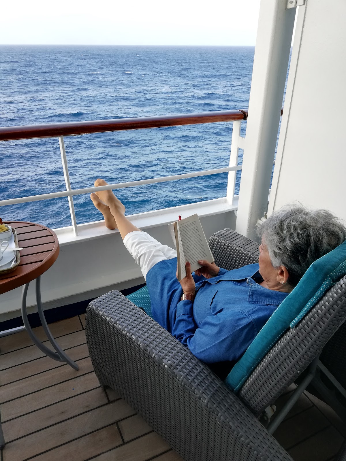
We were so blessed to have a luxury ship to call home throughout our 25 day cruise. If we had spent the day ashore, it was a welcome back "home" by the crew and our butler. Laundry would have been done, room service was available to get a hot drink and snack, while we lounged on our own balcony with a book. Breakfast was always a bigger than big spread. Lunch was your choice if you wanted to pick around the buffet, or be served. But dinner was always a sit down dinner in a choice of 3 restaurants. Or if you didn't feel like dressing smart casual, one could still go to the pool deck in shorts and enjoy a BBQ, burgers, sandwiches and the like....OR if one was not in the mood for any of that, just call room service!
It was also always interesting to watch the captain sail into each port. Some ports would be a challenge to make his way in, carefully avoiding other big or small vessels, while he came alongside, or mostly 'reverse', park sideways, then get roped, secured and lower the gangway. Often the local port pilot would come aboard earlier and guide the captain into a 'tricky" port.
23rd May, port of Santa Cruz, island of Tenerife, Canary Islands, Spain.
The Canary Islands , is also a group of rugged volcanic islands, just 210 miles off the northwest coast of Africa, the island of Tenerife being the largest of 7 main islands of the archipelago. These Islands are the southernmost autonomous region of Spain.
Its indigenous people, the gauchos came from the mainland 1300 years ago. In 1494, the Spaniards discovered the islands, placed a cross and thus named it the city of Santa Cruz, on the island of Tenerife. It was also the first stopover for Christopher Columbus when he was on his way to discover America....for fuel, water, food, fruit and vegetables. Sugar cane plantations saw the import of slave labour from the mainland. Today the Canary islanders are proud of their heritage, majority being Catholics, some Jews, and some Muslims. Many adopted Spanish costumes and lace making.
While docked at the Porte de la Cruz, the impressive Auditorium of Tenerife welcomed us, its gigantic wave shaped building giving the impression of an enormous wave crashing against a rock.
The city is a lively resort town, with brightly coloured boats bobbing in the harbour, and offers activities like kayaking, snorkeling with turtles, yachting, whale watching and so much else. The population of about 1 million is mostly Spanish, thus their language, architecture, food etc. is distinctly Spanish.
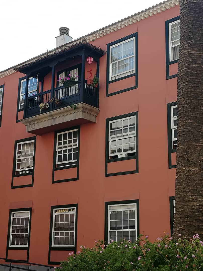
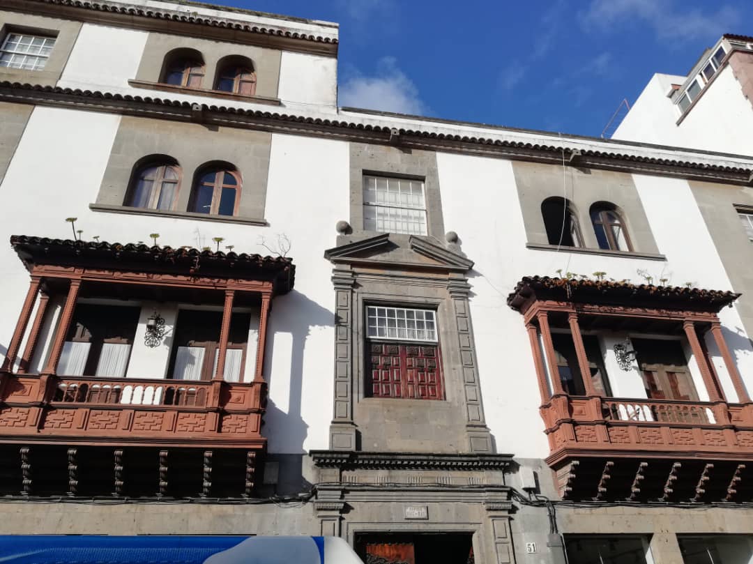
It was a short drive from Santa Cruz to the UNESCO world heritage old city of San Christobal de La Laguna in the idyllic Aguere Valley. The streets have largely remain unchanged here since the 16th century. People continue to live in these well maintained historic homes many boasting protruding wooden balconies giving them a distinct character.
We headed inland through winding roads of laurel forests and botanically rich wilds of the Biosphere Protected Nature Reserve, the oldest part of Tenerife, formed by volcanic eruption 7-9 million years ago, to the Pico del del Ingles Lookout.
The Reserve is popular for hiking and trekking, and its awe inspiring views of the rugged ridges of the Anaga Massif. Here you can eat in cave dwellings, hike through mountains and valleys covered with carpets of laurel trees. The Reserve also boasts the largest number of endemic species of trees and plants. From the lookout, we also enjoyed splendid views of the highest peak in all of Spain, Mount Teide, a dormant volcano at 12,000ft and 4th tallest in the world. In winter it's beautifully snow capped. ( the only active volcano is on the sister island of Las Palmas, which last erupted in 2021) .
Mt TeideThe mountains and valleys are dotted with charming hidden hamlets, like Taganana that offered a refreshing drink of local wines, coffees, home made goat cheese, and bread.
We left the mountains, and descended to the rugged and charming coastline of Tenerife for a coffee overlooking the blue Atlantic Ocean.
Their economy depends largely on tourism with over 12 million visitors per year, attracted by their beautiful beaches, subtropical climate, and natural attractions on most of their islands. There are no industries on the islands, but they depend partly on agriculture of bananas, tobacco, potatoes, grapes,etc.
An interesting note: Having been created from volcanic eruptions, the islands had no animals originally. Dogs and other animals probably drifted here from the mainland with gauchos or accompanied immigrants. The name Canary Islands is likely derived from the Latin name Canariae Insulae, meaning "Islands of the Dogs", a name that was evidently generalized from the ancient name of one of these islands. According to the historian Pliny the Elder, the islands contained "vast multitudes of dogs of very large size".
Thus NO, the islands were not named after the bird.
25th May, Arracife, port city on the island of Lanzarote, Canary Islands, Spain
Population 160 thousand...yes, hardly anybody !!
Lanzarote, is the easternmost of the volcanic Canary Islands in the Atlantic Ocean, and located approximately 1,000 kilometres from the Iberian Peninsula, their "motherland". Covering 846 square kilometres, Lanzarote is the fourth-largest of the islands in the Canary archipelago. Located in the centre-west of the island is Timanfaya National Park, where its desolate and bizarre landscape, and Fire Mountains were created by volcanic upheaval in the 1730s, and declared a biosphere reserve by UNESCO. The island's capital is Arrecife, its port where our cruise ship anchored.
Lanzarote has a subtropical-desert climate. Rainfall during summer is a rare phenomenon, causing dry and dusty conditions across the island, leaving it mostly desolate and barren. Even though a desalination plant was completed in 1964, much water was mostly imported from the other islands until the 1980s.
Few plants have adapted to the relative scarcity of water like the date palm. The locals grow one date palm for every child born on the island, in the Village of 1000 palms.
Efforts to mine salt and grow crops failed. Only basic crops and vegetables with the help of irrigation is grown to feed the local population.
With the help of irrigation, a small Aloe Vera farm flourishes on the island. The pink, succulent and large cacti plant attracts tourists to view and learn about the medical applications of the plant, and its importance as an ingredient in cosmetics, soap, shampoo and even beverages, all processed at the farm.
Their economy depends entirely on tourism. Hundreds of cruise ships dock in the summer months, while other tourists fly in through their small airport.
Unique to Lanzarote Island are small villages with little white cube like homes, mostly single storied. They are so space-age looking against the desert landscape, that movies are often shot here. Omar Sharif once shot some scenes from his movie "Mysterious Island" on Lanzarote. He was so enchanted by the island that he wanted to buy one of these homes. Typical of his character, he spoke to the owner and said " if we play a game of poker and I win, will you give it to me ?" The owner said yes.....and Omar did win !
The earliest records of Lanzarote date from the fifteenth century when it was a small fishing settlement. The name Arracife refers to the black volcanic reefs behind which boats could hide from pirate attacks. In the 16th century, growing prosperity as a stopover for cross Atlantic vessels increased the attractiveness as a pirate target.
At the northeastern point of the island is a natural volcanic outcrop that was used as a pirate lookout tower called Mirador del Rio. It is beautifully adapted, and designed by local artist and architect Cesar Manrique, for tourists today.....with a timber spiral staircase recessed into the volcanic hollows, to safely ascend to a wide balcony with stunning vistas over the Atlantic Ocean towards the mainland, and other sister islands.
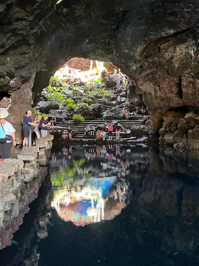
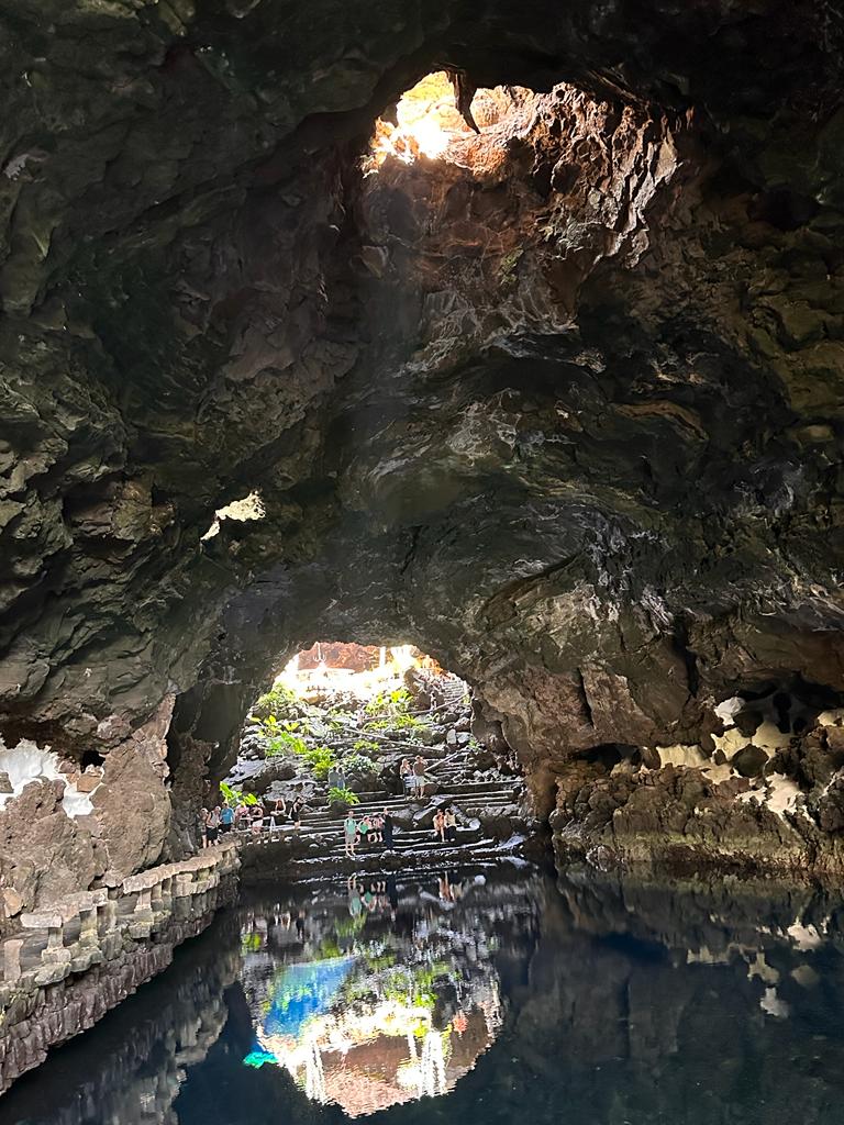
Our last visit on the island was Jameos del Agua, a series of underground lava caves and tunnels, formed by volcanic activity 3000 years ago, near the coast in northern Lanzarote.
We entered a small dark mouth of a cave. Suddenly the hidden lighting revealed a mammoth cave beyond it. There were polished timber steps and handrails to guide us down to a level where there were green plants growing out of the walls, tables and chairs, or timber seats along the cave walls to rest and soak in the aura...everything was black, the floor, the walls of the cave, everything. Rough and sharp edges were smoothened off with contrasting white cement. Tucked away in a little recess was a charming counter to order a meal and a drink, while you sip and savour and soak in the atmosphere, and contemplate. This little cafe was large enough to even host a small wedding reception. How romantic it would be.
As we descended more steps, a large subterranean salt lake of clear water welcomed us. Walking beside it to the other side, we saw a small hole in the ceiling of this gigantic cave, letting in bright sunlight, almost like a spotlight on the water.
There were more polished timber slabs recessed into the volcanic walls on the other side to sit and absorb this magical atmosphere. Then came the time to reluctantly leave this magnificent cave and ascend the steps leading out to bright sunlight.
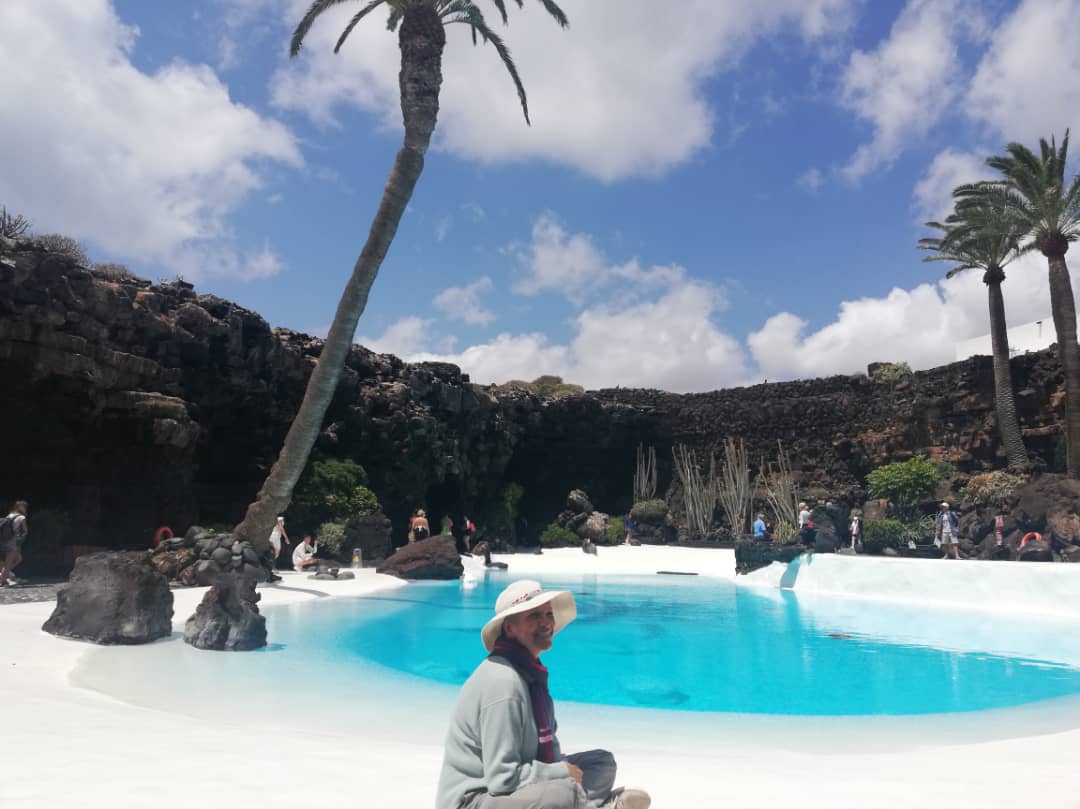
Lo and behold...another striking spectacle awaits us ! In this natural large opening of the cave tunnels, an emerald green pool and palm trees against a setting of black and white, and blue sky takes my breath away. I just sat down on the ground of this heavenly scene, and didn't want to leave.
On the other side of this heaven on earth, was a large dark entrance to another cave....everyone was going in, so I had to find out for myself. It was a natural humongous black lava cave, shaped perfectly for an auditorium. There were rows of seats sloping down to a large stage, perfect for a concert...the acoustics could only be the best. Only thing missing was a piano player or a violinist, to complete the picture. I silently promised myself I would come back here for a concert someday.....to this natural, but magical and haunting creation. A gift of nature and art in harmony, formed nearly without much human intervention.
The whole 'lava tube' is 6 km long, of which at least 1.5 km is located below sea surface, and is therefore called “Tunnel of Atlantis”, situated in the tunnel’s closest section to the coast.
It’s the first center of art, culture and tourism created by César Manrique, reflecting one of his pillars of creativity. The center was officially opened in 1977. New facilities were added for specific purposes, such as the museum. Since 1987, the center is devoted to science and volcanology.
26th May, Agadir, Morocco.
We anchored at Agadir, a major port city, just 500 kms south of Marrakech.
Morocco on the northwestern coast of the continent of Africa had a tumultuous history of German, French and Portuguese conquerors.
Mention Morocco and exotic names like Tangier, Marrakech, Rabat, the Sahara desert, and Casablanca come to mind...much of it through the movies...yes, Morocco has been connected with romance and movies for decades.
In 1959, Greek shipping magnate Aristotle Onassis and his guest, Winston Churchill, visited Agadir, a thriving port city at that time.
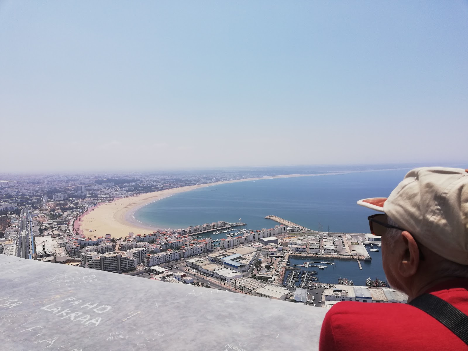
In 1572, the Casbah, an old authentic fortress, was the oldest district of Agadir, on a hill strategically overlooking the coastline. With winding streets and lively shops of food, cafes, and local craft, it was the heart of the city of Agadir for centuries.
However the Casbah and various heritage sites, were entirely destroyed by the 1960 earthquake, and a third of the population perished. Only a restored long high wall of the Casbah remains, but the land inside it, remains unstable. There is, however, a commanding view from it, over the bay of Agadir and the port.
The city of Agadir managed to rise from the aftermath of the earthquake, and is now a thriving seaside resort town.
It has been completely rebuilt by the present King Mohamed VI, and his father King Hassan II before him. By 2004 it had grown to a city of half a million with a large port and marina. Foreign tourists and locals are attracted by an unusually mild year-round climate, and enjoy its 10 kilometer white sand beaches with a waterfront promenade, glamorous resort hotels, culture, food, and souks, etc. From strolling in its palm lined streets, basking under the sun on its beaches, to gorging on Moroccan delicacies, there’s a lot one can do during their stay in Agadir.
Business is also booming with the export of citrus fruit and vegetables. Agadir's economy relies mainly on tourism and fisheries. It is the most important fishing port in Morocco, and a major international sardine port. The commercial port is also known for its exports of cobalt, manganese, zinc and citrus products.
The state preserves and protects the Hassānīya language and all the linguistic components of the Moroccan culture as a heritage of the nation, while Berber remains the official language, alongside the standard Arabic
Agadir has one of the biggest souks in Morocco called Souk El Had. Rebuilt after the quake, it has about 6,000 small shops. It is surrounded by walls and has several entrances. also called the Sunday market, it is organized into different sectors: furniture, crafts, clothing, vegetables, meat, spices etc. One could get lost in its colorful alleys, looking for clothes, shoes, souvenirs, jewelry or the like.
Taroudant is a city situated a 80kms east of Agadir on the way to the Sahara desert and south of Marrakesh. The town is known as the "Grandmother of Marrakech" because it looks like a smaller Marrakech with its surrounding ramparts.
Almost the entire city of Taroudant is located inside its ochre hued walls, like a small fortified authentic Berber marketplace on a caravan route, where local food, spices and crafts, including jewelry and carpets, welcome the traveler. In the 16th century, the Saadi dynasty briefly used Taroudant as a capital before it moved its royal seat to Marrakesh.
It was indeed a romantic and colorful visit.
We were on the final leg of our journey. Soon we would sail through the Straits of Gibralter and visit 2 more cities before we disembark our cruise liner in Barcelona.
27th May, at sea:
This was our last full day at sea. Most of us had started packing, as the next 2 days were port days and then disembarkation early the last morning. The morning went off quietly as most of us were in our cabins. Later in the afternoon however, the captain and his crew spotted what looked like a refugee rubber dinghy not far from us. We were about 50 miles off the coast of Morocco. The passengers, about 20 of them all in life jackets , waved but did not seem to be asking for assistance. The captain slowed down and gradually halted our ship in case they needed help. But they made no sign of approaching us for help. We were kept updated by the captain on the PA system. We waited for more than 2 hours to give them a chance. Instead they sailed away towards the horizon for awhile and then returned within our sight. We were in a busy shipping lane and several cargo and oil tankers passed us by. While we waited, the captain radioed the nearest coastguard off the Moroccan coast to inquire what we should do. How long do we wait? Do we continue our journey? What if they are in trouble and need help?
He was informed by the coastguard that they would keep the dinghy within their radar from then on, just in case. Also since it was a busy shipping lane and if they needed help, it was within sight most of the time. On our PA system, our captain finally announced after more than 2 hours of waiting, that we would have to continue our journey. If they needed help, they would have made a sign or approached us by then. He also said that refugees do not want to be rescued unless their vessel is in trouble. Once rescued, the rescue vessel is obligated to send them to port authorities and thus their efforts to flee would be in vain. We felt so helpless as we continued our journey. All we could do was wish them a safe journey to their destination.
28th May, Motril, Spain
The little Mediterranean port city of Motril used to be synonymous with sugar and sugar cane. The process from sugar cane transformation into various types of sugar, even liquors like the cherished rum of Motril, were the basis of the local economy. Sugar refineries were for many years the "future" of the city. Now they are one of Motril's legacies, but 2006 was the last year in which sugarcane was cultivated. Today the countryside grows crops the climate is conducive to, like avocado, custard apple, guava, mango, banana, lychee, and passion fruit.
Motril is also the gateway to Alhambra in Granada an hours drive away. As we crossed the mountains over deep gorges, rivers and lakes, we also passed orchards of olive trees, oranges, almonds, pistachios, apricots and pomegranates, the fruit from which the region got its name , Granada.
Granada is the capital city in southern Spain’s Andalusia region, in the foothills of the Sierra Nevada mountains. It's known for grand examples of medieval architecture dating to the Moorish occupation, the most famous being the Alhambra. This sprawling eighth century hilltop fortress situated on Sabika hill, the Alhambra Palace provides a breathtaking view of the entire city of Granada. As you approach the palace, you realize it is irregular in shape and consists of numerous towers and smaller structures.
The fortress was begun in 1238 by Muhammad I Ibn al-Ahmar, the first Nasrid emir and founder of the Emirate of Granada, and spreads across nearly 26 acres, with more than a mile of walls, 30 towers and numerous smaller structures included on the site. It is actually a whole citadel within the city of Granada. The fortress was then converted into a royal palace by Yusuf I, the Sultan of Granada. The successors of the Nasrid dynasty kept making additions to the citadel. When the Islamic rule came to an end in 1492, King Ferdinand of Aragon and Queen Isabella of Castile conquered Granada, making the palace their royal court. Under their rule, it was partially modified in the Renaissance style. Consequently, the palace underwent a lot of changes under the rule of Charles V from 1515 – 1556, who ordered the destruction of certain parts of the Alhambra complex to build a Renaissance-style palace for himself. He also built other structures and replaced some—for example, the mosque built by the Muslim rulers was replaced by a church.
There are serene patios, from the Nasrid dynasty, as well as the fountains and orchards and gardens, with bubbling fountains, reflecting pools, numerous gardens, giving it a "Paradise on Earth" theme.
It has the accumulated skills of Muslim, Christian, and Jewish craftsmen, architects, and artisans over the years and it stands as a true testament to their multi-cultural appeal. For almost 800 years, this building witnessed power and love stories from multiple rulers over many centuries. With each age’s cultural influence making its mark, it now stands as an exemplar of Muslim art and architecture in Spain’s history.
For a more natural touch, the palace was designed in such a way that the sun and wind would filter through freely. The genius architects perfected another engineering feature..... the entire citadel is perfectly aligned to work as a massive sundial. At noon, half of the rooms will have shade, and the other half sunlight.
It is no wonder that it was declared a UNESCO World Heritage Site in 1984.
The fabled city of Granada itself is a mesmerising labyrinth of narrow, crooked, cobbled streets, well preserved since medieval times. There is the Royal Chapel, Cathedral of Granada and the Moorish quarter of Albaicin to explore. There are fountains, open squares, villas and ruins to soak in, and rest in between with a cup of coffee. Many of the inhabitants of this quarter are Moroccan, so there are dozens of colorful middle eastern little shops in the maze of alleyways, selling middle eastern as well as Spanish souvenirs, clothes, carpets, jewelry etc.
29th May, Alicante, Spain...our last port of call.
With 300 days of sunlight annually, this southern stretch of the Mediterranean coast enjoys a warm, mild and humid climate throughout the year. As a result the region attracts the geriatric community to settle here toward the last years of their lives.
The main industries of this area includes food, shoes, toys, marble and tourism because of its beaches along the Mediterranean sea. Their airport connects the whole of Europe.
Because the climate here is conducive to the growth of almonds and the rearing of honey bees, the manufacture of Nougat is famous here, and we were fortunate to visit a famous nougat factory in Jijona and shown how its made. They have very high standards of quality and are famous for their brand. Although nougat is consumed all year round, its demand grows exponentially during the Christmas months.
The main ingredients of Alicante nougat are almonds and honey, but for the best nougat, marcona almonds are used, which are much more expensive than other almonds, and rosemary honey.
Alicante nougat must contain at least 46% of its weight in almonds and the Regulatory Council of the Denomination of Origin requires that the honey has been produced in the Valencian Community.
In addition to almonds and honey, Alicante nougat also contains egg whites and sugar, which are used to make a meringue that is added to the honey to make the paste, which is then mixed with the toasted almonds, and which gives this nougat its typical creamy white colour.
Interesting Fact: The origins of Nougat have been traced to the Middle East. Nougat recipes were found as early as the 10th century in Baghdad. The Arabs needed to make long journeys over deserts on camels, and needed food that would last for weeks and months without going bad. They were the ones to first invent nougat all those centuries ago ! From its origins in the Middle East, the confection later spread to Spain and Italy in the 15th century and France in the 17th century.
Alicante is also renowned for the Monastery of Santa Faz.
The main door of this Clarist convent is Baroque in style, and in the interior is a small, ornately decorated room in which is kept the relic known as the Santa Faz; it contains one of the linen folds that tradition says belonged to the linen with which Veronica wiped the face of Jesus on the road to Calvary, and which was brought here from the Vatican, towards the end of XV century.
30th May, Barcelona, Spain.....we disembark our ship, and fly home in a couple of days.
Our last visit to Barcelona was 42 years ago. After we checked into our hotel, we had to go check out the city as well. It was good to refresh our memories of it on a Hop on Hop off bus which took us to the general places of interest and attractions.
In 2011, Barcelona was the 20th-most-visited city in the world by international visitors and the fifth most visited city in Europe after London, Paris, Istanbul and Rome. With its popular tree-lined pedestrian streets, great beaches, mild and warm climate, historical monuments including 8 UNESCO Heritage sites, Barcelona is ranked the most popular city to visit in Spain.
The "Gothic Quarter" is the center of the old city of Barcelona. Many of the buildings date from medieval times, some from as far back as the Roman settlement of Barcelona. Especially remarkable are the works of architect Antoni Gaudí, which can be seen throughout the city. His best-known work is the immense, but still unfinished church of the Sagrada Família.
On 19 March 1882, construction of the Sagrada Família began under architect Francisco de Paula del Villar. In 1883, Gaudí took over as chief architect, transforming the project with his architectural and engineering style, combining Gothic and curvilinear Art Nouveau forms. Gaudí devoted the remainder of his life to the project, and he is buried in the church's crypt. At the time of his death in 1926, less than a quarter of the project was complete.On the subject of the extremely long construction period, Gaudí is said to have remarked: "My client is not in a hurry."
After his death, and relying solely on private donations, the Sagrada Família's construction progressed slowly but was interrupted by the Spanish Civil War. In July 1936, anarchists set fire to the crypt, partially destroying Gaudí's original plans.. Since 1940, several architects carried on the work and by the 1980s, computer designing was introduced into the reconstruction process to save material from Gaudí's workshop and reconstruct plans from photographs.
However, some of the project's greatest challenges remain, including the construction of ten more spires. It was anticipated that the building would be completed by 2026, the centenary of Gaudí's death.
It is described by art critics as "probably impossible to find a church building anything like it in the entire history of art", and "the most extraordinary personal interpretation of Gothic architecture since the Middle Ages".
Having seen it neglected 42 years ago, we were delighted to see cranes and framework around the church, and teams of construction workers busily trying to complete Gaudi's dream project of a 100 years ago!The Columbus Monument near the port, is a 60 m tall monument to Christopher Columbus . The statue depicts Columbus pointing towards the New World with his right hand, while holding a scroll in the left. It was constructed in honor of Columbus' first voyage to the Americas. The monument serves as a reminder that Christopher Columbus reported to Queen Isabella I and King Ferdinand V in Barcelona after his first trip to the new continent.
The impressive Arc de Triomf in the city of Barcelona is built in reddish brickwork. It was built as the main access gate for the 1888 Barcelona World Fair. The arch crosses over a wide central promenade, with hundreds of locals and tourists enjoying a walk up and down the promenade. The front frieze contains the stone sculpture which means, "Barcelona welcomes the nations". The opposite frieze contains a stone carving entitled "Recompense", representing the granting of awards to the participants in the World Exposition. The friezes along the sides of the arch include allegories of agriculture and industry, and of trade and art.For the newcomer, Barcelona is an exciting destination. So much to feel, sense and explore.
I hope you enjoyed reading about our travels to this lesser known part of the world in West Africa. Though we touched only the edge of these countries, I hope I have inspired you to explore more on your own someday.
Shirin Moiz
Kuala Lumpur
